Yichang
In ancient times Yichang was known as Yiling. Historical records indicate that in the year 278 BC, during the Warring States period, the Qin general Bai Qi set fire to Yiling. In 222 AD Yichang was also the site of the Battle of Yiling, during the Three Kingdoms Period.
Under the Qing Guangxu Emperor, Yichang was opened to foreign commerce as a trading port after the Qing and Great Britain agreed to the Chefoo Convention, which was signed by Sir Thomas Wade and Li Hongzhang in Chefoo on 21 August 1876. The imperial government set up a navigation company there and began building facilities. Since 1949, more than 50 wharves (with a total combined length of over 15 km) have been constructed at the port.
During the Second Sino-Japanese War, Yichang was a primary supply depot for the defending Chinese army. In October 1938, as the Japanese moved up the Yangtze River towards the strategic city of Chongqing, it became clear that Yichang needed to be evacuated. In 40 days, under the direction of businessman Lu Zuofu, more than 100,000 tons of equipment and 30,000 personnel were transported upstream by steamship or by porters pulling smaller vessels through the Three Gorges rapids to Chongqing.
In 1940, the Battle of Zaoyang-Yichang took place in the area.
Map - Yichang
Map
Country - China
 |
 |
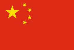
| Flag of China | |
Modern Chinese trace their origins to a cradle of civilization in the fertile basin of the Yellow River in the North China Plain. The semi-legendary Xia dynasty in the 21st century BCE and the well-attested Shang and Zhou dynasties developed a bureaucratic political system to serve hereditary monarchies, or dynasties. Chinese writing, Chinese classic literature, and the Hundred Schools of Thought emerged during this period and influenced China and its neighbors for centuries to come. In the third century BCE, Qin's wars of unification created the first Chinese empire, the short-lived Qin dynasty. The Qin was followed by the more stable Han dynasty (206 BCE–220 CE), which established a model for nearly two millennia in which the Chinese empire was one of the world's foremost economic powers. The empire expanded, fractured, and reunified; was conquered and reestablished; absorbed foreign religions and ideas; and made world-leading scientific advances, such as the Four Great Inventions: gunpowder, paper, the compass, and printing. After centuries of disunity following the fall of the Han, the Sui (581–618) and Tang (618–907) dynasties reunified the empire. The multi-ethnic Tang welcomed foreign trade and culture that came over the Silk Road and adapted Buddhism to Chinese needs. The early modern Song dynasty (960–1279) became increasingly urban and commercial. The civilian scholar-officials or literati used the examination system and the doctrines of Neo-Confucianism to replace the military aristocrats of earlier dynasties. The Mongol invasion established the Yuan dynasty in 1279, but the Ming dynasty (1368–1644) re-established Han Chinese control. The Manchu-led Qing dynasty nearly doubled the empire's territory and established a multi-ethnic state that was the basis of the modern Chinese nation, but suffered heavy losses to foreign imperialism in the 19th century.
Currency / Language
| ISO | Currency | Symbol | Significant figures |
|---|---|---|---|
| CNY | Renminbi | ¥ or 元 | 2 |
| ISO | Language |
|---|---|
| ZH | Chinese language |
| UG | Uighur language |
| ZA | Zhuang language |


